Documents
| Item | Reference |
| Plan of Wellfleet dated May 1795 | [1] |
| Plan of Wellfleet made by John G. Hales, dated 1831 | [1] |
| Plan of Wellfleet made by Oliver Arey, dated 1841 | [1] |
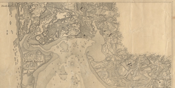
| Wellfleet-1853 (1870) see note (1) Digital Commonwealth Library of Congress |
[1] [2] |
| Wellfleet Harbor Proposed Improvements-1887 | [3] |
| Wellfleet sheet, Atlas of Massachusetts, USGS -Sept 1893 edition | [2] |
|
Plan of Wellfleet Harbor (1915) |
[4] [5] |
Notes:
- Although the Digital Commonwealth map includes “Date of first publication 1853”, the presence of Central Wharf (1863) and Mercantile Wharf (1870) on both editions means map editions shown are 1870 or later.
Also note the indication of Union Wharf on Chequessett Neck.
References:
